Six questions about snowfall forecast! What is the difficulty in judging whether it is raining or snowing?

On January 20, during the cold season, Beijing and other places ushered in the first snowfall in 2022! As the first round of large-scale rain and snow in the New Year, there are small to medium snow or sleet in Qinghai-Tibet Plateau, Northwest China, North China, Huanghuai and western Hubei, and there are heavy snow and local snowstorms in eastern Shaanxi, southwestern Shanxi, southern Hebei, Henan, western Shandong and southern Tibet. On the other hand, there is rainfall in many places in the south.

However, compared with rainfall forecast, snowfall forecast is much more complicated! People want to know,Also affected by a strong cold air, is it rain or snow?Can the depth of newly added snow be predicted? What is the difficulty of snowfall forecast? Therefore, China Meteorological News reporter interviewed meteorologists to find out!
01
What’s the difference between forecasting snowfall and forecasting rainfall?
First of all, it needs to be clear that rain and snow are different phases of water, so in meteorology,Snowfall forecast and rainfall forecast can be collectively called precipitation forecast.
We know that no matter whether it rains or snows, we need to meet the basic conditions for precipitation, and most of the snowfall occurs in the precipitation weather under the winter climate background.
Similarities:Meteorological factors such as large-scale circulation background, water vapor conditions and dynamic conditions that need to be paid attention to in rainfall forecasting are also important in snowfall forecasting. At this point, the forecasting methods and techniques of the two are also consistent.
Differences:Winter precipitation is often accompanied by the phase transformation process of rain and snow. Accurate phase prediction is the basis of snowfall and snow depth prediction, which are not available in rainfall prediction.
When we pull the angle of view to the vertical altitude of several kilometers, we can find that the temperature at different heights of the atmosphere is not evenly distributed, and the morphology of precipitation particles has various changes at different heights and in different temperature and humidity States.The precipitation phase will also undergo a very complicated transformation.

Schematic diagram of atmospheric temperature changing with height. Snowfall only occurs in the troposphere.
When ice crystals or snowflakes fall down in the clouds, it’s like an unknown adventure.
Only when the whole floor is cold (for example, below 0℃) will snow fall to the ground. If the temperature of the whole layer is higher than 0℃, it will turn into rain.In fact, the temperature change between layers of atmosphere is often more complicated than imagined:
Case 1: If the temperature in the upper and lower floors is lower than 0℃, but there is a shallow warm layer in the middle, and the snow in the upper floors melts in the middle warm layer and then freezes in the middle and lower cold layers, then it is ice particles.
Case 2: If the warm layer in the middle is thick, it will rain if the snowflakes in the upper layer are too late to freeze after melting in the warm layer in the middle.
Situation 3: If the ground temperature is high or the water content of snowflakes is high, sometimes snow falls, and it is difficult to form obvious snow on the ground, but it is wet.
In reality, the real vertical atmospheric temperature, influenced by the atmospheric circulation system and complex dynamic environmental conditions, is not so simple stratification, and the surface temperature near the ground is different, which makesWhen and in what form will the "naughty child" of precipitation enter the public’s sight? Need a complex comprehensive judgment.

The national precipitation forecast map released by the Central Meteorological Observatory at 6 o’clock on January 20, 2022.
02
What is the difficulty in judging whether it is raining or snowing?
Rain, sleet, snow, freezing rain, ice particles, snow, snow, etc …There are many forms of precipitation in winter, and the transition between phases has a very complicated mechanism. The core is the vertical change of temperature and water vapor in the atmosphere.

Snow-covered landscape
At first glance, there are four necessary conditions for the formation of snowfall: low temperature, water vapor saturation, upward movement and condensation nuclei in the air. To integrate these four factors, it is also necessary that the ascending motion must be extended to the temperature layer conducive to the development of ice crystals, which is usually at least -10℃.
Carefully, the vertical distribution of temperature and humidity in the atmosphere is very complicated, including the height from -10℃ to 0℃, the thickness difference between related temperature layers, the temperature from the ground to the condensation height of water vapor, the height of cloud bottom, and the path, intensity and moving speed of cold air, as well as the underlying surface conditions such as topography.The key factors affecting the phase transition of precipitation are mutually restricted and have a non-fixed relationship with the formation of rain and snow phases.
In short, it is a scientific and technological problem to predict when and where it will rain or snow, which needs the support of three-dimensional meteorological comprehensive observation data, corresponding numerical forecasting model and objective forecasting method.
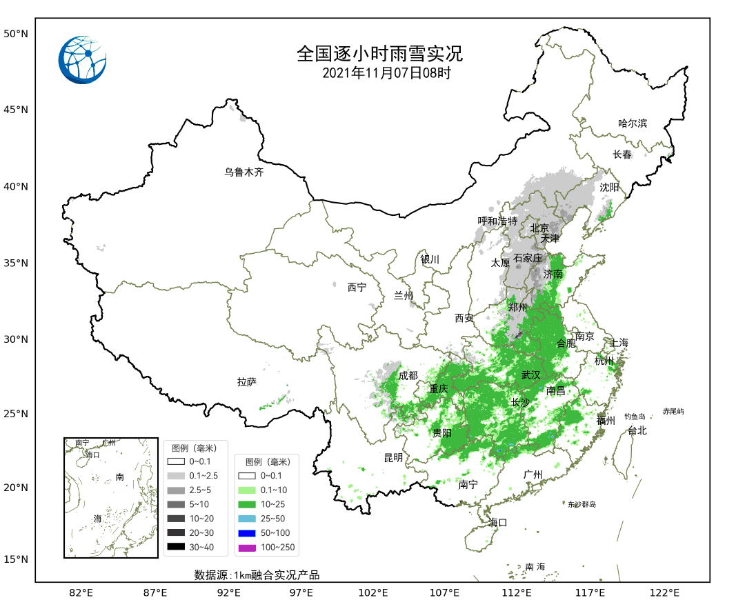
The hourly rain and snow situation in China reflects the evolution of precipitation.
At present, the prediction of ground precipitation phase model is mainly obtained by the vertical distribution of water content in the cloud combined with the vertical profile diagnosis of ambient temperature, and the subjective phase prediction is also mainly based on the temperature threshold at key levels. However, the actual precipitation phase is related to the complex cloud microphysical process, and the phase distribution described by the temperature profile model or threshold is still quite different from the phase characteristics in the actual cloud.
Therefore, phase prediction has always been a difficult point in winter precipitation prediction, and it is a long way to go to clearly explain the complex mechanism behind this change.
03
Is it easy to predict the depth of snow?
How high can 1 mm snowfall accumulate? This is closely related to ice crystal structure, temperature layer and humidity layer structure, vertical movement of atmosphere, surface temperature and snow moisture content.
According to statistics,The ratio of snow depth to snowfall in winter in China is about 0.75 cm/mm,It means that for every 1 mm of snowfall, about 0.75 cm of snow is formed.
However, this ratio tends to decrease obviously with the increase of temperature, and there are significant regional differences.For example, the snowfall caused by the same cold wave, due to the influence of surface temperature, wind and other conditions, the amount of snow in the south is often not as much as that in the north, and the amount of snow in cities is not as much as that in mountainous areas. thereforeSnow forecast not only needs to pay attention to the "stories" in the atmosphere, but also to the complex situation on the ground, and the difficulty of forecast is increasing.
It can be said that snow depth prediction is an international problem.
At present, global models such as EC (european centre for medium-range weather forecasts) and NCEP (National Center for Environmental Forecasting) all provide snow forecast products, but they are all instructive and have some differences with business requirements.

The staff of the observation field of Tongliao Meteorological Bureau in Inner Mongolia carried out intensive snow depth observation
In recent years, China has also carried out a lot of work in snow depth forecasting, and gradually promoted the snow depth forecasting business. However, due to the limitation of observation data in winter for a long time, forecasters have insufficient understanding of the characteristics, influencing factors and forecasting techniques of snow depth during snowfall, which makesSnow depth prediction is still a difficult problem.
04
What factors will lead to blizzard?
The formation of blizzard needs abundant water vapor, strong lifting power, cold enough temperature and suitable temperature layer structure. In addition, the above conditions need to last for a certain period of time to form a blizzard.
For example, a nationwide cold wave that started on the evening of November 20, 2021 brought snowstorms and heavy snowstorms to Northeast China.
The cold air of this cold wave comes from Siberia, and in the process of moving eastward and southward, on the one hand, it meets the warm and humid air in the southern region to form precipitation; On the other hand, warm and humid air currents from the northeast and the sea surface form extratropical cyclones. The cyclone not only continuously transports warm and humid air to the north, but also provides lifting power for the convergence of cold and warm air. As a result, cold and warm air meet in the northeast where the temperate cyclone front is located, forming a blizzard.

True color monitoring map of FY-4A meteorological satellite
05
What meteorological products can the general public refer to to predict the approaching snowfall?
Weather radar can see the information of precipitation, but compared with summer, the precipitation in winter is less in magnitude, so even if it is a blizzard (precipitation is more than 10 mm), strong radar echoes such as "tomato scrambled eggs" are rarely seen on the radar map. Therefore, to understand the snowfall process, it is best to pay attention to the latest weather information released by the meteorological department.
06
What is the current snowfall forecasting ability in China?
What other shortcomings are there?
Quantitative precipitation forecast is the most traditional and core forecast business of the Central Meteorological Observatory.At present, the Central Meteorological Observatory has produced and released a gridded quantitative precipitation forecast product with a spatial resolution of 5km, with an interval of 1 hour in the next 3 days and an interval of 3 hours in the next 10 days.
In the aspect of precipitation phase prediction, it has been upgraded from rain and snow prediction to rain, sleet, freezing rain and snow prediction. For the snowfall forecast, there are not only the snowfall forecast but also the snow depth, including the new snow depth forecast.
Today, the short board of snowfall forecast still exists.Li Zechun, an academician of China Academy of Engineering, once put forward four points around the difficult breakthrough of snowfall forecast:
First of all, improve the ability of extending short-term and medium-term forecasting and short-term climate forecasting, and improve the prediction level of cumulative effects of continuous snowfall.
Secondly, by building automatic weather stations, carrying out intensive observation and other measures, the fine degree of snowstorm forecast will be improved.
Third, strengthen the grasp and research on the mechanism of precipitation phase change.
Fourthly, make full use of microwave radiometer, temperature profiler, wind profiler, dual polarization radar and laser raindrop spectrometer to monitor and physically analyze the local atmospheric structure and changes.
The meteorological departments have already carried out research on the mechanism of occurrence and development of snowstorms in the north, and constantly encouraged meteorological departments at all levels to carry out research on snowfall forecasting techniques and methods suitable for local conditions.
up to this day
With that improvement of numerical forecast model
Improvement of forecasting technical ability
Aiming at the influence of rain and snow freezing disaster
Risk assessment and decision-making service
But also play a greater role in emergency response.
(Source: China Meteorological Bureau)
Reporting/feedback